Sunday 29 October 2017

Auckland to Wellington - The Dimholt Road, Cape Palliser, and Near Disasters en Route to Wellington.

The Putangirua Pinnacles, better known as, "The Dimholt Road", the home of the cursed undead in The Lord of the Rings.
Mission accomplished to Taranaki, now all I needed to do was make my way down to Cape Palliser and then across to Wellington.  The long range forecast was changing all the time, and on short tours to New Zealand, weather watching is pretty important.  I wanted to make it to Cape Palliser before the forecast rain could spoil the last really scenic part of the tour.  That meant some more big days.

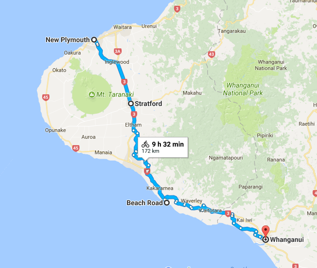
I set-off from Whanganui a little after lunchtime, after the bus back from New Plymouth, and I at least needed to get as far as Palmerston North by the end of the day.  On the days I was hiking on Mount Taranaki, there were quite fierce westerly winds, which would have seen me literally breeze-through this stage of the ride, but typically, when I actually got back on the bike, the wind had shifted to the South East, which meant headwinds for most of the day.  It was a hard 70Km or so to Palmerston North.

My only option in Palmerston North was an expensive campsite, so I decided to ride on and find somewhere to free camp.

In a stroke of bad luck, the Manawatu Gorge road was closed due to a landslide earlier in the year, which would have provided a nice scenic crossing between the Ruahine Ranges to the North and the  Tararua Ranges to the South.  The route I had to take instead took me more directly to Pahiatua, but with a big climb at the end of the day of nearly 400m.  I was looking for somewhere to camp before this, but there was nothing.  Everywhere was fenced-off and the parts that weren't were boggy and impossible to pitch a tent.  I had no choice but to cycle into the night to find a campsite in Pahiatua.


I arrived after 9 o'clock at a small campsite and I only paid $5.  I was pretty exhausted, 112Km in about half a day with headwinds wasn't bad going.  My plan the next day was to make it to the DOC campsite at the Putangirua Pinnacles on Cape Palliser road, still a fair distance away, but a much flatter day, so very doable.


I made it to the campsite at about 6pm, about an hour and a half before sundown.  Just enough time to explore the Putangirua Pinnacles, an area of very eerie rock formations that were used as the path of the dead (the Dimholt Road) in the final installment of The Lord of the Rings Trilogy.  They are extraordinary structures, and certainly spooky to walk around in the fading light on your own, and especially when I had minutes earlier been given a major fright.


In one of the more stupid moments of my life, I had my phone in one hand and my camera in the other while making my way down from the high lookout to the pinnacles.  As I made my way to a clearing for a good photo opportunity, I knocked my hand on a wooden barrier, which sent what I thought was my phone - with all my money and cards - flying out of my hand and careering down a steep forested slope (very steep).  Panic swept over me and I began sliding down the slope searching among the thick, and very spiny undergrowth.


The mixture of trees and spiny bushes was making it very difficult to find my phone and after nearly half an hour of panicked looking, I decided to try and calm down and take a break and try and look carefully again from the top of the slope just where the phone could have fallen.  I made my way back up and once at the top I realised that I had just left my phone on the top of the wooden barrier all along.  I must have kicked a rock down the slope and knocked my hand at the same time, then leaving my brain to very convincingly turn that rock into a green wallet with a phone in it.  What a moron.


This buffoonery left me with less time to explore the pinnacles from the river bed, where they were most spectacular, but I still wondered around in awe for quite a while.  One of the most unique places I've been too, without a doubt.


I somehow managed to find my way, in the dark, back to my bike to set up camp.  I woke early the next morning and headed to Cape Palliser before the forecast rain set in too badly.  Cape Palliser is remote and beautiful, even in slightly dreary weather.  The last 5Km to the lighthouse is unsealed, and I wouldn't have wanted it to be much rougher on my touring bike.


On the way, there was stunning coastal scenery and plenty of fur seals lying on the grass next to the road.  There is actually a trail that continues beyond the lighthouse, but it requires a wider tyres at least and probably a mountain bike to ride on.


As the day went on, the weather started to deteriorate.  I was actually quite lucky to get most of the scenic part of the day done before the weather really set in.  I made my way back out of the Cape Palliser area, taking a few more pictures on the way.  From the lighthouse, it was about 60Km to a small settlement, Pirinoa, which was basically a couple of houses, a petrol station and a coffee shop.  I was pretty wet and tired, so I spent about an hour in there resting and charging my phone.


I was intending on going about 110Km in the day and getting to the start of the Rimultaka cycle trail, which would take me through the mountains and finishing a few Kms short of Wellington the next day.  I had a problem, however.  The rain just kept coming and didn't stop for the rest of the day.  I was getting so wet and cold, and combined with being absolutely nothing around me, I was getting a little concerned.

I needed to find some shelter from the rain, and eventually I found a picnic area with a big shelter over a picnic table.  I had internet on my phone and the weather forecast was grim reading, basically, a lot more rain.  I began to question the wisdom of doing the rail trail with so much rain about.  I took off all my wet clothes and camped there for the night, as I was pretty sure no one would disturb me.  I actually camped on top of the picnic table inside my tent, as at about sunset it was clear that my vicinity to Wairarapa lake was quite attractive for the mosquitoes.  There were thousands of them.  I find that there is always that one terrible camping night on every trip, and this was the one for this trip.  It was truly miserable.

The next day, I had a decision to make; cycle the Rimultaka trail through the mountains - a difficult 40 or so Kms - or just cycle about 15Km to Featherston train station to skip the busy roads into Wellington.  I really wanted to do the trail as a cool ending to the trip, but the weather was so bad and my clothes so wet, it seemed unwise.  I opted for the train option, arriving a little earlier in Wellington than planned.

A day before I notice that my tyre was gently brushing my brake pad, so I adjusted things slightly and thought nothing of it.  Then on the short trip to Featherston, I noticed it again.  Wet and generally a bit fed-up with just a few Km to go, I ignored it, but towards the end of the short cycle into town my bike definitely wasn't feeling right.  Anyway, I released the brake on my back wheel and I hopped on the train for the short journey into Wellington, my finishing destination.

As I took the bike off the train and wheeled it down the platform, I noticed that the back wheel wasn't just catching on the released brake pads, but actually on the frame itself!  It was wobbling around all over the place.  I looked down to the wheel, which had completely gone.  It was cracked like the picture below in several places.  I guess the combination of 20 000 or so Km on previous trips and some of the rough roads had stressed it to the point of absolute failure.  I couldn't even have cycled it another 50 metres.


It was of course unfortunate that my bike had broken, but also incredibly lucky that this was the time it chose to fail me.  I simply walked the bike to my friend Alex's house, a couple of kilometres away - who had kindly, once more, offered to put me up for a couple of nights - and that was the end of the trip.  It was even sort of handy, as on the way back from Melbourne airport, the Skybus dropped me off right outside the bike shop I go to.  Having no public transport to my apartment means that I usually have to get a taxi, costing much more money.

Anyway, it was good to see my old mate Alex again.  On my last trip to New Zealand, I also stayed with him, but that time he was in Wanaka on the South Island, which was a stunning place to stop for a few days.  He has luckily located himself in some very convenient places for me and has been the perfect host on both occasions.  Many thanks old chum, and feel free to ask anything in return in the future, as after a year or so more in Australia, I might be in some interesting places over the next few years.  That's the plan anyway.

I managed to organise a bike box from a local shop and quickly got it back to Alex's house between the rain showers and packed everything up.  After nearly 3 days of continuous rain, finally I could see blue sky again, so I went out for a run up to Mount Victoria to get a view of Wellington before I left.


It had been an eventful trip, and another successful one (just).  I tweaked the route slightly from the one originally planned, but things did go pretty smoothly.

Just a bit of warning for fellow bicycle tourers; I got slightly caught-out by Air New Zealand's baggage policy.  I had flown with them before and as long as I had purchased extra baggage in advance, they accepted one bag being over the allotted 23Kg (my bike box with other gear was about 30Kg).  However this time they didn't and I had to pay a fee of $120 at the airport.  I would have repacked, but my flight was one of the first out in the morning so the check in was open quite late because the airport closes overnight.  I did however get a refund of this when I got back to Melbourne, as I took great pains to let them know how unhappy I was with paying it.  I have found airlines quite willing to refund extra charges for all sorts of things if you do some sensible and persistent moaning.

Next on the horizon is an arduous week tour in the mountains near me in Melbourne at about Christmas time, then a very opportunistic trip to the US in February for two weeks, followed by some exciting plans for the second-half of 2018 and my biggest challenge yet!

Tour Summary


Total Distance: 965Km

Total Ascent: 7234m

Daily Average when Cycling (8 days of cycling, 3 days hiking, 2 days in Wellington) = 120.62Km

Total Spend: Approx $400 (Not including flights), working out at $30 a day, pretty much entirely for accommodation and food.


Saturday 21 October 2017

Auckland to Wellington - Hiking Taranaki, Cycling New Plymouth to Whanganui.


Hiking Mount Taranaki was the centre-piece of this particular trip.  I was gutted that I missed out on it last time, so it was a must-do.  The problem was always going to be the weather.  Taranaki sticks out of the West coast of North Island, and with a height of over 2500m, it obviously attracts a lot of cloud from an already cloudy and rainy part of the country.

I had covered a lot of ground on the first 3 days of the tour, not only to give me time, but because the weather had looked promising on the long-range forecast on day 4 of the trip.  However, as I looked out of the window in New Plymouth in the morning, things didn't look so pleasant.  Upon checking the forecast for the mountain, the window of possible good weather had shrunk significantly.


I decided to ride to Egmont village, where the road turned towards the visitors centre 15Km away about 900m up the mountain.  Things weren't looking good.  Ever since I arrived in the Taranaki region, you wouldn't have known there was a mountain there at all.  The weather forecast was also grim for the next day, so I eventually decided to just ride on.

Yep, there is a mountain there.  It finally became visible from the road.
The new plan was to ride about 100Km to Patea on day 4 and then onto Whanganui after that,then leave the bike in a reliable hostel - which I had frequented on my previous trip to New Zealand - and then take a bus back when the weather looked a little better.  The only difficult part was getting up to the mountain and back again, as I really didn't want to pay for an expensive shuttle bus up there.

Shipwreck on the beach at Patea.
First then, the journey from New Plymouth to Whanganui.  I was preparing myself for a bit of a boring couple of days, especially compared to what I had been doing.  I was on main roads in dull and dreary weather, and also was pretty spent from the first 3 days of the trip.  The cycling was dull, but the free camping in Patea, as well as the gorgeous black sand beach and sunset there made up for it.  An added bonus was that there were working public barbecues in the free camping areas, as well as seating areas, which made for quite a comfortable evening.


The next day I only had about 60Km or so to get to Whanganui.  I was going to stay at the same hostel as I did a year previously, as they were fairly laid-back and I knew they'd keep my bike safe for a couple of days.  60Km was more than enough as I was feeling pretty beat-up and I had a headwind for most of the day.  I arrived, bought loads of food and booked my bus back to Taranaki for later the following day.

My plan was to stay in a hut near the Dawson Falls visitors centre on the Monday evening, then hike to the start of the Pouakai Circuit (the most famous long distance walk in the park) on Tuesday morning and stay at a hut on the circuit on Tuesday night, finally finishing the hike after lunch on Wednesday (the weather was supposed to be at its best on Tuesday and Wednesday).  About 36Km of hiking in total.


One of the great things about the huts in New Zealand is that they usually have plastic mattresses in them, meaning you don't have to bring something to sleep on, just a sleeping bag.  So I stuffed my smallish bag with a good sleeping bag and food, and pretty much nothing else but water and one set of dry sleeping clothes.


I caught the bus back to Stratford then, on Monday, but I still had to get to the visitors centre at Dawson's Falls, about 25Km away.  The only way to do it was hitch hike.  Because of the bus being delayed, I actually got to Stratford a lot later than planned which meant there would be less people going up to the Falls.  After about 45 minutes of trying, a kind soul eventually picked me up and took me the whole way there, leaving me just enough time to have a look at Dawson Falls and then make it to the hut before sundown.

Taranaki at sundown from the hut.
I was the only person in the hut that night, and it was quite nice, although a little cold.  I set-off early the next morning, strolling through dense forest on a slightly dodgy track that hadn't been maintained for a long time.  There were quite a lot of trees down across the path and it was generally ill-defined, keeping me on my toes to avoid getting lost.


The mountain fleetingly came into view between the trees and on the stream crossings as I made my way to the other side of the mountain.  After hiking for most of the morning, I made it to the visitors centre and the start of the Pouakai circuit.  After a spot of lunch, I was expecting a harder hike uphill, but easier underfoot, as this was a popular track and must be well maintained.  I was wrong.


Last year, Lonely Planet named the Taranaki region as number 2 in their top ten places to visit in the world, naming the Pouakai Crossing one of the best day hikes in New Zealand, and an underrated region generally.  Since then the mountain has seen a lot more visitors, although mainly in the summer months, the mountain was quiet while I was there, with few people hiking the crossing or the circuit.  My problem wasn't crowds but the state of the track.  Churned-up and eroded by people over the summer, the recent rain made it muddy and super wet.


To save weight and space on the trip, I had only packed my minimalist running shoes, so this made a hike to the summit out of the question, although the weather was very windy anyway, and a trip to the summit might have been unwise, especially alone.  I think the footwear actually worked in my favour.  There was no way anyone was keeping their feet dry anyway, and my shoes dried a whole lot quicker and were much lighter.  Still, it was slippery, muddy, and to be honest quite an unpleasant walk in some sections.

The swamp and surrounds, shrouded in morning cloud.
I stayed overnight at Holly Hut, with a few others and a roaring fire, perfect for drying all my wet clothes.  I got there with a bit of time to spare before bedtime, so I had some long chats with a few of the people who were also staying there.  It had been sunshine and showers all day and everyone was pretty wet, both from the weather and the state of the trail.

It was again cloudy the next day, which was disappointing as I felt like the views around me would be spectacular.  Fortunately, just in time, the clouds cleared and the mountain showed itself once more with the swamp in the foreground.  Absolutely spectacular.  Taranaki is an almost perfect cone volcano, and with snow near the top, it was picture perfect.

The clouds finally cleared for a fantastic view.
I had been lucky enough to get great views just before I descended into the forest again, making my way back to the visitors centre.  Once I got on the road, I was looking again to hitch a ride, this time back to New Plymouth.  Luckily, I succeeded first time; a nice old man and his granddaughter gave me a lift as far as the city park.  It was just a short walk from there to another hostel for the night.

Lovely city park in New Plymouth
I had an early bus to catch in the morning back to Whanganui, and I was feeling pretty satisfied that I had done what I'd set out to do, despite some complications with the weather.  The bus was again delayed, this time because of a clip holding parts of the engine at the back had broken, leaving a trail of sparks behind the bus, unbeknownst to the driver.  Fortunately, someone driving behind called it to his attention upon making his first stop.   After a frustrating wait for a replacement, it was another couple of hours before I was back at Whanganui, it was a quick lunch and back in the saddle again for the final section of the trip.


Friday 13 October 2017

Auckland to Wellington - Days 1 to 3: The West Coast


Day 1: Auckland Airport to Raglan
So this wasn't the first time I had cycled from Auckland to Wellington, but this time I was going an entirely different route.  It was always my intention on this tour to cover big mileage on the first 3 days, as the centre-piece of this particular tour was always going to be Taranaki, and I knew the weather would be unpredictable and I might have to wait around or modify my plans.  With this in mind then, after landing in Auckland with next to no sleep after a late night flight from Melbourne, I knew the first day would be testing.  I had about 145Km to cover to make it to Raglan.


On the first night, bearing in mind I had no sleep the night before, I planned to stay in a hostel so I could have a comfy bed and a good night's shut-eye.  Over the next 12 nights on the trip, however, I only paid for accommodation twice, which is not a bad effort for New Zealand because anyone who has visited will know how difficult it is to free camp there, as almost all areas are very well fenced-off.

The first day was pleasant enough, nothing spectacular, but rolled up and down the hills.  It probably was a fairly ambitious target for the first day, but I arrived into town at sunset, basically perfect timing.  A good start to the tour, back in the saddle and bang on schedule.

Raglan at sunset.

On Google, the information about the YHA hostel in town was incorrect, leaving me with a more expensive option of a BBH hostel, as the YHA was actually about 7Km out of town near the surfing areas, and of course, up a rather large hill.  At first, I thought about camping, but as usual in New Zealand, if you go to a campsite, it ends up being just as expensive as a hostel.  So for the same price, a nice warm bed with other comfortable facilities seemed the better idea.

As it was, the BBH hostel was an excellent call.  It was an amazing hostel, I had a quiet and comfortable room and one huge bonus was that the central area of the hostel was outside and had a Jacuzzi!  I had a quick shower and then soaked in the tub for half an hour before going to bed; my legs really appreciated it, it was like heaven.  I slept like the dead and woke up feeling pretty refreshed, luckily so, as I had an even bigger day ahead.

Day 2: Raglan to Waikawau (a little short of here).


This day ended up being one of the best days of the trip; fantastic weather, beautiful waterfalls, and remote and scenic roads.  However, it was also probably the most physically exhausting.  Big climbs, many on unsealed roads, with very few amenities, and even fewer people around.

As the profile above shows, there really were hardly any flat sections, and the day consisted of about 70Km of unsealed road.  Although quite difficult at times to cycle on, the unsealed section was fantastic; a very scenic and enjoyable part of the day.  At almost 100 miles of cycling (155Km), this day took quite a lot out of me.  I really felt it at the end of the day, and suffered a bit for the next couple of days as well.  Still, suffering is all part of the appeal of bicycle touring.

The stunning Bridal Veil Falls.
The first stop of interest of the day was Bridal Veil Falls.  I have seen a few waterfalls on my travels now, but I really liked this one.  Tucked-away in native bush, but not all that far off the road, it really felt like an ancient, remote, and special place.  And as usual in New Zealand, especially at this time of year, I was the only one around.  I lingered around for a while and took in the splendor of this very pretty waterfall.

After the falls my map was sending me down a road with signs saying "no exit", so this worried me a little.  I didn't want to back-track and everything on my map seemed okay, so I decided to risk it.  The further down the road I went without a sign, though, the more worried I became that I might have to go back and waste a significant portion of the day.  Fortunately, that never happened, just a very hilly, very pretty road with absolutely no cars.


After a short, but predictably steeply uphill detour, I arrived at my second waterfall of the day, Marokopa Falls.  A much bigger and more powerful waterfall than Bridal Veil.  I was pretty tired at this point, so I stopped for a needed hour's rest and ate and drank as much as I could.


After this, I wasn't exactly sure how far I was going to get or, more importantly, where to camp.  I kept riding until well past sunset.  No cars had past me all afternoon, until one guy pulled-up alongside me and asked where I was going and then said there would be places to camp just over the next hill about 6Km away or so.  This was a relief as all I could see around me were miles and miles of fenced-off farmland on very wet ground.  I asked how big the hill was, and his reply was "It shouldn't take you too long".

The climb ended-up being one of the biggest of the day at about 300m.  I was worried that he might have also got the details of possible camping areas wrong, so I was always on the lookout for possible camping spots.  I eventually stopped, right at the summit of the climb, where I saw a flat piece of ground set back from the road.  It still wasn't far from the road, but seeing as I had only seen one car in about 3 hours, I figured that no one would be going past at after 8.30pm.  I was right, I heard nothing all night.

Day 3: Waikawau to New Plymouth


I had drizzly rain for most of day 3, but not enough to get soaked-through, so it wasn't too bad.  The first 30-40Km were actually very pretty, even in the rain.  It was a much easier day, only punctuated by two decent climbs, but the previous day made things hard-going.  However, I knew there would be a hostel at the end of it, and that I'd probably be done by mid to late afternoon, enabling me to get some good rest.


In the morning, I past a fellow bicycle tourer from Germany.  He was being a lot more sensible than me and taking his time, doing about 50-60Km a day.  He had the time though, and seemed to be planning to do exactly the same kind of thing I did a year earlier.  I gave him some tips on good roads and sights, especially in the South Island that he shouldn't miss.

In future tours, I am planning on taking things a bit more slowly, taking my time and cutting-down the daily mileage, but this year has been a story of multiple shorter tours, and so with limited time, I've still had to put my foot down a little and grind-out the distance.  I was certainly a little envious of this German fella taking his time to enjoy things a bit more.  Although I like the grind, I am starting to yearn for some easier touring.


I eventually wound my way out of a mountainous valley and found my way to the coast, the last 40Km being on a main road with some cars for a change.  I had only seen a handful of them over the previous two days once I got clear of Auckland.  After one more climb, I had made it to New Plymouth; about 420Km in 3 days, mainly over hills and mountains.  I was surprisingly not too sore, but utterly exhausted.  Cups of tea and plenty of food for the rest of the day, ready for a good night's sleep and hopefully good weather for some hiking up Mount Taranaki the following day.