Sunday 30 April 2017

The Snowy Mountains Part 2 - The Alpine Way and Mount Kosciuszko


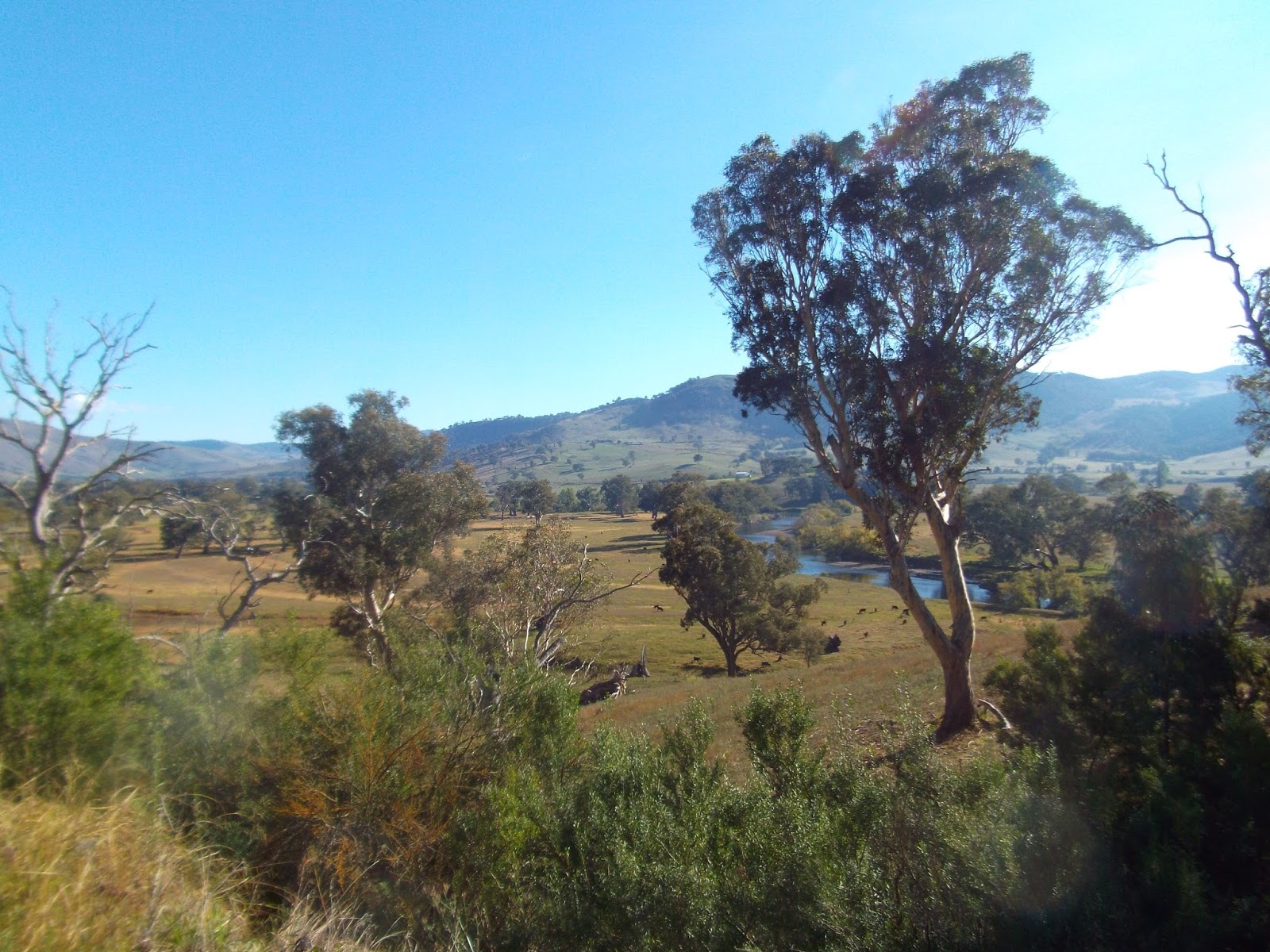
Into the mountains then, and the meat of the tour.  Almost as soon as I hit the sign for the high country, the climbing began, and when I got to the sign for Mount Kosciuszko National Park, the climbing began to get silly.  This wasn't going to be a simple, relaxing jaunt through gently sloping mountain passes.  The gradients were severe, and almost impossible to cycle at times.

Later on in the trip, I passed a fellow cyclist who told me that the climb up to Thredbo (the town at the base of Mount Kosciuszko) was one of the hardest - if not the hardest - in Australia.  I wasn't aware of this before I started, but I did realise the Alpine Way would be challenge.

The challenge of climbing mountains through the winding roads on bike is always somewhat daunting, but when you add a heavy touring bike loaded with gear, it makes the task quite a bit harder.  You're not looking to break any speed records, it is just about getting to your destination somehow, and this is far from easy.  It is even problematic should you choose to give up trying to cycle and just push the bike because pushing nearly 40kg of bike up a steep mountain road isn't a walk in the park either and it is very slow going.

On the second day of the trip, I had set myself a difficult target of making it to Tom Groggin campground, about 25Km shy of Thredbo.  I knew this would be difficult, not only because it was over 150Km from my campsite overnight, but also because I knew the climbing would be tough. Doing 150Km in one day on the flat is hard enough.  I needed to hit this target, however, because I wanted most of the day in Thredbo so I could hike up Mount Kosciuszko, Australia's highest mountain.

There were several climbs during the day, but two big ones in particular.  The first up to Scammel's Lookout at about 1000 metres and then - just when I thought I'd finished my climbing for the day - there was another seemingly unending stretch of about 600 metres, before the final descent into Tom Groggin.


The real problem I had was the severity of the ascents and descents.  So steep on the way up that it was difficult to stay within my lactate threshold, even in my lowest of gears, and so steep on the way down that I felt like I was receiving almost no rest at all before the next climb.

When climbing on a bike, it is so important to choose a gear that won't sap you of strength too quickly.  Once you have hit your lactate threshold and the lactic acid begins burning your legs, it becomes extremely problematic to get your legs functioning again.  When you have hugely steep roads on a heavy bike, though, the lowest of gears can send your heart rate spiraling and make your legs so fatigued, you don't really know what to do with yourself, you just don't know how you can go any further.

Although things were difficult, the roads were going through some spectacular high country and the hardship sort of made the whole experience that much more worthwhile.  It is as if mountains were put on this earth to test us and reward us for the effort taken to climb them, whether on foot or by bike.

Looking back down what I just cycled up.  The picture doesn't really tell the true tale of how steep this really was.

I'd left my overnight camp at 6.30am and I made it to Tom Groggin, after a grueling day, at 6pm with only a small break for lunch.  One of my toughest days in the saddle, for sure. I had a quick bite to eat in the darkness and slept like a baby from about 7pm until 5am the next morning, despite the freezing temperatures outside.

It was only about 25Km to Thredbo, but it ended-up taking me nearly 4 hours to go this paltry distance.  It was  steepest climbing I had ever done going from Tom Groggin campground to Dead Horse Gap at nearly 1600 metres - the mountain pass just before Thredbo.  Note that this road was about 600 metres higher than the highest sealed road in New Zealand and I can assure you that it felt it.

The highest point of the cycle at Dead Horse Gap at 1580 metres.

I think it seems slightly strange that a mountainous country like New Zealand doesn't come close to Australia when it comes to the height of their highest roads.  In New Zealand, however, you have to take the weather into consideration.  What's the point in building a high road if you can't use it for most of the year due to snow, ice, and other adverse weather?  Really, there are so few roads in New Zealand and they twist themselves around and through the lowest passes possible through the mountains, taking many huge detours in the process.  Not so in Australia, where many roads go right up to the top of mountains, and because the weather there is a lot warmer for most of the year, and the weather conditions more stable, they can build them like this.

After Dead Horse Gap, it was a gentle downhill into Thredbo, a ski resort town in the Winter and a centre for hiking and mountain biking for the rest of the year.  It was a huge relief to get there.  One of my inspirations for cycle touring is a chap called Mark Beaumont, and I remember him talking once about the deepest, darkest places of endurance sport.  He really pushes the boundaries of endurance in what he does on a scale I can only dream of, but I can assure you that cycling up to Thredbo on a loaded bike will come close to breaking almost anyone and I started to know what he meant when describing this dark place of despair.  I was exhausted, truly exhausted.  There was almost nothing left in my legs, partly down to the day before also, and I wasn't sure how I was going to climb Mount Kosciuszko, the centre-piece of this particular trip.

The view of Thredbo from the chairlift.

To me, the suffering is partly why I enjoy cycle touring and similar activities in the past like marathon and ultra-marathon running.  You can certainly be much more leisurely cycle touring; choosing your route carefully and doing less mileage in a day and I have done this in New Zealand and will take more leisurely tours again in the future, but the challenge gives an extra sense of achievement and a connection to your wild surroundings.  Travelling under your own steam, you feel everything; the cold wind, the burning sun, the fatigue, the rain, the smells, the sounds, and the exhilaration of your surroundings.  What better way to travel?


I wasn't entirely sure what I was going to do for a place to stay the night, but my condition encouraged me to take a long-shot and see if there was space in the YHA hostel in Thredbo.  It was Good Friday, so I wasn't that hopeful of a bed, but luckily there was one dorm bed left.  This meant I could get a shower, have some good food and have a proper rest.  But first things first, I had a mountain to climb.

Throughout the trip I was blessed by fantastic weather, but on the first couple of days the highest peaks were still shrouded in cloud.  However, I was in luck again.  I arrived on a perfect sunny day, with the clearest views possible.  A week earlier there had been a huge storm in South-East Australia which had caused problems all over the Victoria and some parts of New South Wales and dropped some early snow on the mountains, some of which stayed on the highest peaks.

I had to take a chairlift to the beginning of the hike to the top of Kosciuszko.  Even after the lift, there was still about 13Km of hiking to be done.  Due to the perfect weather and the Easter holidays, there were more people around than I had expected, but it wasn't that busy.  Most people were taking the chair lift to the start of the downhill mountain bike tracks, which looked good fun.

At the top, with a little snow in early April in Australia!

At 2228 metres high, Mount Kosciuszko is a reasonable height and there is quite a fair sized mountain plateau around it.  Most of the peaks in Australia have been weathered and have rounded tops, so there are few, if any jagged peaks like I saw in New Zealand.


I was back down by 3pm, which meant that I could put my feet up for the rest of the day and let my legs recover a bit.  A warm hostel, a sofa, cups of tea and coffee, and a dorm bed feel like absolute luxury when you are tired.  I also knew that the next day wouldn't be easy either.  I'd have about 40 Km and then I was heading down the Barry Way for two days the last leg of my journey, for more climbing on unsealed roads through the Snowy river valley.

Wednesday 26 April 2017

The Snowy Mountains Part 1 - The Murray River Road


6 months after returning from New Zealand, I was itching to get back in the saddle and go on another tour.  I ended up picking a tour of about 5 days, but I couldn't have chosen a much harder route.  Huge climbs, few services, dangerous roads, and unforgiving surfaces.  However, it was through some of the most stunning areas of the the most mountainous part of Australia.

Three fantastic roads, starting in Albury on the Murray River Road, then leading up to Australia's highest mountain on the Alpine Way, then crossing the alpine wilderness to Bairnsdale on the Barry Way (sometimes called The Snowy River Road).  To start things off, it was the relatively simple stretch along the Murray river road.


This leg was to take about a day to complete and was a pleasant, gently undulating ride along the Murray River, starting at Lake Hume.

The Dam at Lake Hume must have changed the landscape of the Murray river as the river was vast in some areas and drowned trees dotted the landscape, making for a fairly unique looking backdrop.


I left Melbourne on the train in the early hours of the morning and arrived just before lunchtime in Albury.  I had a target of about 85Km on this first day and would finish at a free camping reserve by the river to camp overnight.  I didn't leave the river the whole day and it was a scenic, easy ride.


I wasn't expecting too much from this first leg and was focusing much more of the mountains on the Alpine Way and Barry Way.  However, the Murray River was wonderfully scenic along the whole length I cycled.  As usual, Australia didn't disappoint with the wildlife as well, parrots, parakeets, cockatoos, eagles, kangaroos, and freshwater turtles on the banks of the river.

Last year, when I cycled the length of Australia from Darwin to Melbourne, I was actually at the other end of the Murray River in South Australia.  The Murray River is the 15th longest in the world at 2373Km long, and the longest in Australia.  I was at the end of it that time, this time I was near its source.


After camping by the river overnight, and sleeping incredibly soundly for about ten hours I awoke feeling very refreshed and followed the river on for another 50Km or so until I reached the high country and the start of the Alpine Way.  Along the way, I made sure to savour the beautiful weather and the peaceful misty morning on the river.


As well as the hills to come, this cycle imposed some logistical challenges as well, one of them being finding food and water.  With so few towns and services on all three of the roads I would be cycling on, I had to make sure I could fill-up the bottle and re-fuel the body wherever I could.  It was with great relief then, that I found a perfect water stop at a small village called Walwa, just before heading to the high-country.  I was pretty keen on not carrying too much weight in water, about 4 litres maximum.  I suppose I could have sourced some of the water from the Murray river with a bit of filtering and treatment, but it is always good that this is a last resort measure.

Fully stocked-up on water, and with plenty of food, I made my way to the high country and the expected hard-yards on the bike.  It certainly wasn't going to disappoint in this regard.


Friday 7 April 2017

The Snowy Mountains Wilderness Tour Ahead

After the raging success of my first two bike tours, I am not about to stop anytime soon. However, finding a spare few months isn't always easy, so with that in mind, I have a couple of shorter tours planned this year of between 5-10 days each.

The first of these is back in Australia.  I've had a couple of months out of the saddle and now I'm itching for another tour.  I can't go far, money isn't too bad, but I do have to establish some consistent work so I can save for something really epic.  

I decided to not stray too far from my base here and spend 5 or 6 days in the Australian Alps, scaling the highest mountain in Australia in the process, Mount Kosciuszko.

The ride is a picturesque one, along 3 beautiful rural roads first following the Murray River East on the Murray River road and then up to Thredbo, a town at the base of Mount Kosciuszko, via the Alpine Way, and then down to Bairnsdale on the Barry Way, an unsealed narrow mountain road through the mountains.  Despite this ride taking place in the Easter holidays, I am not expecting much in the way of traffic on any of these roads, especially the Barry Way and the Murray River Road.

This is not an easy ride, so I had to squeeze in some training bikes beforehand.  The roads are steep, and large sections unsealed, and as usual in Australia, when you go a little way outside the major cities, very remote, with little in the way of facilities.

Early April tends to be the most settled time of year weather-wise in Victoria, the extreme heat of the summer should be gone, and also there should be some pretty autumn foliage around, so that seems the perfect time to go.


As you can see from the above cycling profile, the route is not an easy one.  It passes right through the great dividing range, taking the highest route through the Australian Alps.  These roads are actually higher than in New Zealand, and the elevation gain over the 5-6 days I will be cycling is probably the hardest I have faced over such a distance.

To make matters worse, between Bairnsdale and Thredbo (Just under 300Km), there really is virtually nothing in the way of services, just a whole lot of high-country wilderness.  Whereas I faced long distances in the Outback without support, the road was flat and fast.  This promises to be pretty slow-going.  The named landmarks spaced-out on the map, like "Suggan Buggan", are not really towns or villages, they are literally just one or two farmhouses with no shops or any other amenities (in fact, only 3 people live there).  I'll have to make sure I am loaded-up with supplies.

Obviously, I don't live in Bairnsdale or Albury, so I plan on getting out to Albury on the train and coming back to Melbourne from Bairnsdale on the train.  Doing a whole loop starting and finishing in Melbourne would take too long.

Dangers

Obviously, some dangers apply.  This particular journey is not going to be a comfortable one, staying in hostels like I did in New Zealand.  Most nights I will be wild camping in the forest.  This obviously leaves me at a slight risk from the local wildlife, the usual nasties, like snakes and spiders, but also ticks, which apparently kill far more people in Australia by spreading disease.  

I also know from previous experience of running in the forests of the high country last year, that in wet weather, leeches are present in unbelievably large numbers.  They aren't really dangerous, but they are definitely unpleasant.

Safety on the road is always an issue, and I suspect my main danger in this regard will be drivers on narrow roads and blind corners on the switchback roads up and down the mountains.  At least logging trucks shouldn't be a problem, as I will be in a national park for most of the time, with logging activities not allowed.

The weather, however, is my greatest concern.  It shouldn't be snowy yet at this time of year, although it is certainly possible, but rain could really make things difficult and potentially dangerous on the narrow unsealed roads, especially as many of these roads have sheer drops without barriers.

I only have a narrow window for this trip and then it is back to work, so if I need to bail on it, I need a back-up plan of another place to go.  However, with few roads in this area, finding one could be difficult, so fingers crossed!

Wildlife

The wildlife is always a pleasure in Australia.  You almost always see something of interest, whether it be the ample and varied colourful birds, or the many marsupials for which Australia is famous.  Koalas, wombats, kangaroos, wallabies, possums, and maybe even platypus in the streams, inhabit the areas I will be travelling through.

It is quite exciting to hit the road again, and this should be a really great tour.  6 days in the remote mountain wilderness of Victoria and New South Wales, on some of the most picturesque roads in the country, and camping out under the stars in the bush.  There's nothing better.


Sunday 2 April 2017

Weekend Training Bikes Around Melbourne


Before my big bike tours of Australia and New Zealand last year, I needed to do some practice runs.  There was plenty to discover; how far I could ride, camping routines, what I needed or what I didn't need, and generally what to expect.

I find I need a target of a big trip to get me out and about around Melbourne, as the areas around Melbourne aren't as spectacular.  However, there are still some really excellent areas to go and do long one day and two day tours.  Here are some of what I have done, both before and after my two big tours so far.

Lilydale to Moe


This was my first overnight camp with an almost fully-loaded bike.  Including all the bikes to and from train stations, the cycle totaled about 90Km on day one and about 60Km on day two.  

Everything east of Melbourne starts to become quite hilly and even mountainous at times, so there were some very testing sections on this first ride, including a 6Km section of climb after Noojee of about 1000 metres ascent, not easy.

Camping at Noojee Trestle Bridge

I didn't know what to expect on this first outing, but gained a lot of confidence fairly quickly after a (quite literally) shaky start on the loaded bike.

St Kilda to Cape Schanck


My first day of over 100Km on the bike and I was rewarded by a beautiful sunrise after a sneaky wild camp and loads of ring tail possums for company.  Some surprisingly arduous hills after that, but it was all character building stuff.


I'm not a great fan of riding through the city so I got a train back from Frankston and on that train, as fate would have it, I met a quite extraordinary woman.  She was quite a small 77 year-old lady and she started up a conversation with me about cycling.  She told me that she does the same as me and I just assumed that she was one of the many weekend cyclists in the city.  However, she revealed that she had completed a number of cycle tours around Australia herself, some in groups and some solo.  She had done Adelaide to Darwin following the same route as I would be doing (just in the other direction), Darwin to Perth, Melbourne to Sydney, Perth to Melbourne along the Nullarbor Straight, and a whole host of others since she started cycling in this way when she was 62.  She obviously couldn't do the sort of miles daily as I could, but with careful planning she explored some real hardcore routes through Australia, on dirt tracks, camping rough, and going through some of the most remote and dangerous areas of Australia.  Truly inspiring, and if she can do all this in her 60's and 70's, surely I can do it in my thirties.

Wilson's Promontory


I headed out of the city first on the train and then back from a different location.  Over 300 Km total, and 130Km on the first and last days with a big hike in the middle. This trip was incredibly hilly, but it was important to hit my needed average before I went on the big one through the Outback last year.  This trip was long overdue as I was thwarted by extremely wet and wild weather throughout June, which hampered my ability to get out on the bike at the weekends.  Two nights wild camping also, and I still managed to hit my daily goal with plenty of time to spare.

The ups and downs of the Strzelecki Ranges

The cycling was actually pretty difficult as my route crossed the Strzelecki Ranges, a low mountain range that forms part of the Great Dividing Range east of Melbourne.

A good test for the last of my preparation rides before the big ones and a beautiful destination in Wilson's Prom, the most southerly point of mainland Australia.


There was a heck of a lot of wildlife in Wilson's Prom, and a lot on the side of the road while cycling.  So much so that I actually witnessed a kangaroo being hit by a car in front of me, poor thing.  It was still alive, unconscious but clearly breathing, on the side of the road as the driver checked it and called for assistance.  I never saw the kangaroo on the way back and hoped that it survived, which I guess was a possibility, as it was a pretty sturdy animal. It did give me pause for thought about what might happen to me if I hit one at 50Km/h going downhill.  I'm guessing I might have come off second best. I proceeded with due vigilance from then on.

I did get to see plenty of wildlife in good condition, though.  Kangaroos watched on as I biked by and wombats greeted me a Tidal River, as well as some deserted and gorgeous beaches.

The cutest animal in Australia


All the previous routes were completed before my big tours of Australia and New Zealand.  I took a few months to settle back into normal life, but now I am keen on a couple of shorter tours this year.  Both are potentially very tough, though, with lots of ascent, so I needed to do some training runs.

The Lilydale Loop Via Mount Donna Buang


This is a challenging ride.  Only 105Km, but with a huge climb of over 1200m in the middle.  I actually have been up the mountain on this route before; I ran up it last year on the hiking trail, and then ran down the road I will be cycling on.  I did this as training for my ultra-marathon.  That time, I had to contend with hundreds and hundreds of leeches on the trail, this time I'll just have to go up the road I ran down.  I saw many a cyclist struggling up the road that day, on light bikes with no baggage.  I was on a heavy bike with a bit of baggage, so I could simulate a long climb with the weight of my equipment on the bike for my upcoming tour through the mountains.


I was actually quite pleasantly surprised, firstly how comfortably I managed the summit of Mount Donna Buang, and also how beautiful the ride was.  It was a stunning morning on the Lilydale to Warburton rail trail with great valley scenery in the morning light, and then some fantastic views at the top of the mountain.  Another thing, that pictures don't tell, is the amazing smells of Australian forests.  They are so fragrant in the right conditions, smelling of eucalyptus right the way through the forested mountain.

From the bottom.....

To the top.

At the summit I was joined by a number of cyclists, who were riding up from Warburton and back down, some even doing it twice, would you believe.  I was taking a different route down to Healesville via a dirt track through the forest.  Although the other cyclists were quicker than me, none could do this track as it was too rough for their bikes.  My wider tires and robust frame can handle well-maintained non-sealed roads, and that road was a very pleasant and isolated road down the mountain.


Absolutely superb training run, one of my favourites to date; great scenery, challenging climbing and about 50Km or so of unsealed track to boot.  Just what I needed for my trip through the Snowy Mountains.


Hurstbridge Loop Via Kinglake and Healesville


Very little traffic, plenty of testing climbs, nice roads, and lovely scenery.  I chose this for my first training ride back after a few months off after my tour of New Zealand.  I was after hills, and this was a testing, but not overly steep reintroduction to hill climbing.


The first section from Hurstbridge to Kinglake was a steady 600m climb over about 20Km through the Kinglake Ranges.  After that there were a few gentle ups and downs to Toolangi and then a long, steady descent all the way to Healesville, which was really pleasant.

The hills continued through to Yarra Glen and then another stiff climb came shortly after.  By the time I was back to Hurstbridge, I knew I'd had a day on the bike.  The whole ride took just short of 6 hours to complete, with the odd short rest stop on occasion.

Dandenongs (Multiple different rides)

Probably the most accessible training area for hill climbing around Melbourne, and a place where I did most of my ultra-marathon training last year.  The ride I post here is my most recent and longest one through the region.


The Dandenongs is a nice natural area of tall gum forest not too far from Melbourne. Some of the hiking trails get pretty busy at the weekends, but the further you go, the quieter it gets.  In certain areas the wildlife is amazing, with the highlight the famous lyrebird, which can be heard and often seen going through its amazing repertoire of calls, mimicking all the other birds of the forest - and other bizarre sounds, like car alarms, cameras and chainsaws - with seemingly 100% accuracy.

There are some challenging climbs in the area, which is quite popular with cyclists.


So these are a few of the rides around Melbourne I do to get my body and mind prepared for the longer trips to come.  Coming up in a couple of weeks (at the time of writing) will be 6 days in the Snowy Mountain wilderness, with some of the biggest climbs I will have done to date.